 |
| See Slideshow |
Thursday, August 30, 2018
Rochefort-en-Terre, Brittany, France
Tuesday, August 28, 2018
Saint Goustan, Auray, France
By the fall of 1776 the War of Independence between the newly minted United States of America and Great Britain was in danger of being lost to Britain as the USA ran out of money and resources. France, for centuries Britain's arch-rival, was seen by Congress as the only hope to turn the tide and Benjamin Franklin, a personal hero of mine, was selected to visit France with his nation's begging bowl.
Duly, in December 1776, Franklin arrived in Port Saint Goustain in Britanny, France, on his way to see the French King and his advisers. Saint Goustan, named after the patron saint of fishermen and sailors, is on the south coast of the Brest peninsular in northwest France, about 10 miles up the Auray river and 300 miles from Paris.
After much prevarication, Franklin eventually reached agreement with the French who joined the war effort and the rest eventually became history. This French largesse however, motivated by their desire to get one over on the Brits, almost bankrupted France and was certainly a contributing factor in Frances own revolution a dozen years later.
St Goustan, originally a fishing port, served as a boat building center and a commercial port until it was sidelined by the railroad in 1860. Today, this tiny commune is part of the much larger Auray community and exists mainly as a tourist attraction centered on the Franklin Quay and the Franklin Inn. See Slideshow.
 |
| See Slideshow |
After much prevarication, Franklin eventually reached agreement with the French who joined the war effort and the rest eventually became history. This French largesse however, motivated by their desire to get one over on the Brits, almost bankrupted France and was certainly a contributing factor in Frances own revolution a dozen years later.
St Goustan, originally a fishing port, served as a boat building center and a commercial port until it was sidelined by the railroad in 1860. Today, this tiny commune is part of the much larger Auray community and exists mainly as a tourist attraction centered on the Franklin Quay and the Franklin Inn. See Slideshow.
Friday, August 24, 2018
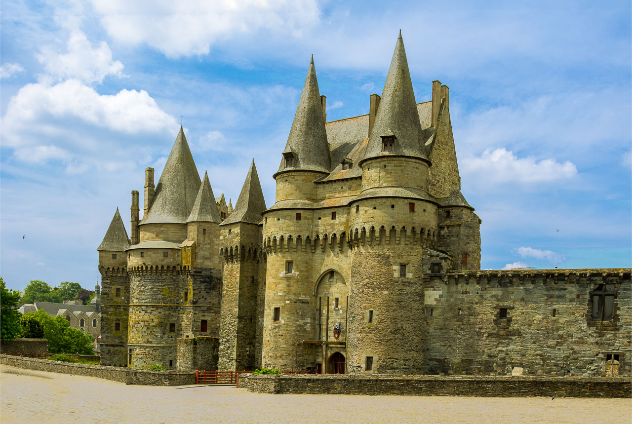
Vitre, Britanny, France 2018
 |
| See Slideshow |
Vitre has a population close to 18,000 and is pretty much on the border of Brittany with Lower Normandy. Designated by the Ministry of Culture as a town of artistic and historic significance, it is in the top 40 cities in France by count of historic buildings. The present Fairy Tale castle dates from the 13th century and currently houses a museum, although, we were disappointed not to see Rapunzel during our visit.
A former famous resident of Vitre, Mme de Sévigné, spent a lot of time at a Chateau on the outskirts of town that also now houses a museum. The main attraction there however, is the French garden which was designed by the creator of the gardens at Versailles. In all, a very memorable
experience. See Slideshow.
Monday, August 20, 2018
Villedieu les Poeles, Avranches and Saint Sever Calvados, Normandy, France
Villedieu les Poeles
 |
| See Slideshow |
Villedieu-les-Poêles is a small city of 3,900 people in Normandy authorized by the Government to use the accolade "City & Art Trades" in recognition of its tradition of copper working since the Middle Ages. Products have included kitchen utensils, brass-ware, cauldrons and the like since the "City of Copper and Pewter" was created in the 11th century by the Knights Hospitaller. The inhabitants are known as Sourdins from the French sourd, meaning deaf, from the time that most workers in the manufacturing of copper pans, which involved repeated hammering, became deaf.
Our visit was cut short by a mishap making our next destination truly "accidental" since we we arrived there by ambulance!
Avranches
 |
| See Slideshow |
Having sampled the French EMS and the mind-numbing "hurry up and wait" routines of the hospital in Avranches, we decided on a late lunch and an exploration of this slightly larger town, population around 8,000. In 511 the town became the seat of a bishopric and later, the location of Saint Andrews, a major cathedral. In 933 the area was ceded to the Normans and became part of William the Conqueror's stomping ground.
Saint Sever Calvados
On the way back to base we decided to stop by this little burg that we had seen the previous day. Not a lot to see beyond a once grand abbey, it is yet another example of slowly atrophying French village with its declining population now less than 2,000. See Slideshow.
Saturday, August 18, 2018
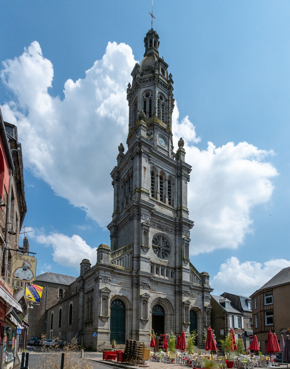
Vire, Normandy, France
 |
| See Slideshow |
Vire suffered quite heavily during bombardments at the end of the Second World War, and much reconstruction and renovation took place in the following decade. The Church of Notre-Dame in Vire dates from the 13th - 16th centuries but includes elements from later periods and is predominantly in the Gothic style. See Slideshow.
Wednesday, August 15, 2018
Landelles et Coupigny, France
Back in the Spring we decided to re-visit Lower Normandy and Brittany in northwest France to fill in some gaps left following previous trips. We took a ship from Florida to Dover, England, disembarked a day early in Cherbourg, France, picked up an SUV and drove south to our first base, Landelles-et-Coupigny.
In 1789, the year of the French revolution, it is estimated that there were as many as 60,000 parish churches in France making them one of the most commonplace durable landmarks. The parishes were generally quite small even at that time but, following the extensive population migration to the cities in the 20th century and steadily declining church attendance, thousands of rural and small city churches are now unable to sustain themselves. There were at least three national legislative attempts in the 20th century to compel the merging of adjacent moribund communities but they were strongly resisted for obvious reasons.
The villages of Landelles and Coupigny, were ahead of their time in this regard and actually merged around the time of the revolution at which time each village had a population just more than 1,000. Over the ensuing 2 plus centuries the population of the merged villages increased to more than 3,000 in the 1960's but has since dwindled to less than 900. In recent decades, thousands of such small communes have been clumped into local communities of communes which essentially manage the provision of services such as water and trash pick-up. Inevitably however, with church attendance now at just 11% and urbanization nudging 80% the demise of tens of thousands small parish churches is only a matter of time. Visit them while you can! See slideshow.
 |
| See Slideshow |
 |
| See Slideshow |
Thursday, August 09, 2018
Domfront, France 2018
 |
| See Video |
 |
| See Video |
Another notable sight in town are the ruins of the medieval castle which was besieged by William the Conqueror, duke of Normandy in 1049. In 1092, the town's people revolted against the owner, Robert II de Bellême, and transferred their allegiance to the third son of William the Conqueror, Henri Beauclerc. Henri went on to become duke of Normandy and later, the King of England. Turbulent times continued for the next six centuries with ownership changing numerous times resulting from the location on the border of Normandy and Brittany.
In the adjacent community of Domfront-en-Poiraie is Notre-Dame-sur-l'Eau, the church of Lonlay Abbey priory. Built between the eleventh and twelfth centuries, it suffered many insults over the ensuing centuries but remains a key example of architecture in this region, although practically nothing of the original structure remains.
Lonlay Abbey itself is in the nearby village of Lonlay and its construction likely took place from the middle of the eleventh century until about 1100. Typically Benedictine in style, it is a good example of Norman Romanesque architecture. More pictures here.
.
Saturday, August 04, 2018
Horta, Azores 2018
 |
| Click for video |
Horta's economy is supported by agriculture, livestock farming, fishing, and tourism. Not a lot to see beyond an interesting glimpse into Portugal's colonial past but a welcome walkabout to break up an Atlantic crossing. The climate is very mild, being influenced by the Gulf Stream, with daytime temperatures normally falling in the range of 60F to 75F, although it is generally wet and cloudy. See some sights here.
Hamilton, Bermuda
 |
| Click for video |
Juan de Bermúdez, a Spanish sea Captain, was the first European believed to have recorded the islands, hence the name Bermuda. In 1684 the English Crown took over administration and in 1707 the islands became a British colony. Unlike the Caribbean islands to the south, Bermuda feels much more substantial and is certainly less gaudy although there is not much to be accomplished in a 9 hour visit except to gawk at a few buildings. A few of Hamilton's structures can be seen here.
Saturday, March 31, 2018
Liverpool Reprise, 2017
 We last visited Liverpool in 2011 and, at that time, had focused on cataloging some of the numerous city center pubs, visiting both cathedrals - Roman Catholic and Anglican, checking out China Town and marveling at the disappearance of 7-1/2 miles of dockland. In doing so, we completely overlooked the tawdry "birthplace of the Beatles" and the sorry little industry that has sprung up to exploit their fame. So, taking advantage of a brief stopover in this reinvented city, we decided to make amends. (Incidentally, if you ever find yourself in this interesting burg with a few hours to spare, a visit to each of the cathedrals is highly recommended to witness the dramatic differences in style.)
It is probably not possible to accurately separate fact from fantasy in the Mathew Street reconstruction that passes for the Beatles birthplace today. It is about sixty years since the group first appeared and, for a decade or two at that time, Liverpool had already been laboring under a painful transition from vibrant dockland to dereliction and latterly on to rebirth as a commercial center over the following decades.
Many years after hitting the music scene spotlight it was recognized that the Beatles were indeed an enduring phenomenon and that some kind of shrine marking their origin should be developed. In the interim however, buildings had changed hands, been re-purposed or even torn down and replaced, making the identification of many features impossible. In true huckster style and simply ignoring inconvenient facts, the entrepreneurs, intent on chasing their pots of gold, latched onto whatever property was available and developed a mishmash of make-believe and reality that continues to draw myriad tourists on a daily basis. Additional pictures here.
Friday, March 16, 2018
Rotterdam, Netherlands, 2017
 |
| Courtesy By Unknown Public Domain, https://commons.wikimedia.org/w/index.php?curid=196261 |
During WWII, the Germans seized the port after bombing it into submission in 1940. From this moment on, the city became an Allied target for the remainder of the hostilities. By the time the war ended in 1945 all but two historical buildings remained salvageable in the city center with the rest of the area being reduced to a wasteland.
Post-war reconstruction gave rise to much experimental architecture during the latter decades - the eighties and nineties - some of which was somewhat over the top. Nonetheless, the city is again a vibrant cultural and commercial success albeit with a few questionable oddities on display and very little in the way of historical sights. For more images, click here.
Subscribe to:
Posts (Atom)
